|
|
||||||||||||||||||
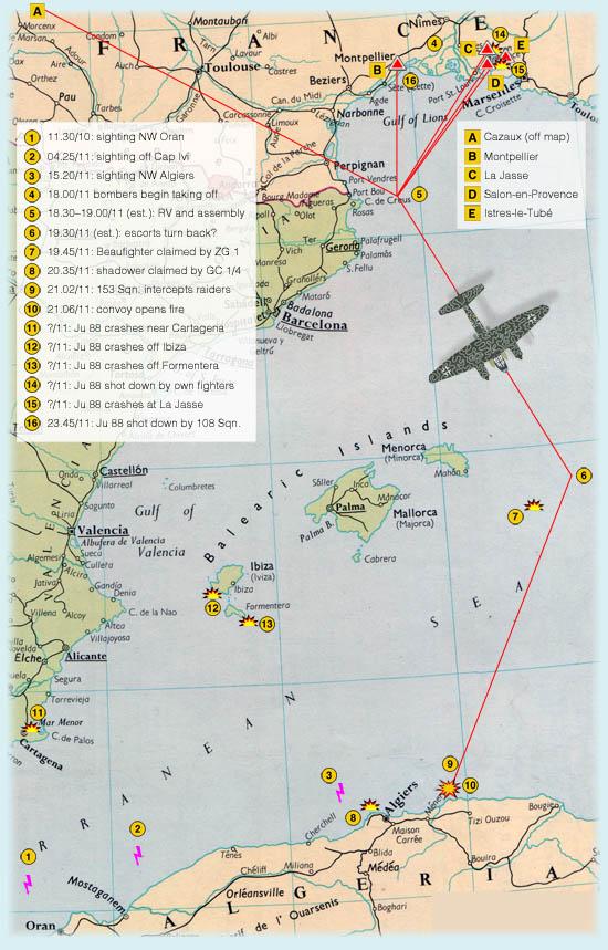
This map shows how the convoy was shadowed and the route flown by the attackes from their bases to contact off the Algerian coast. Almost everything here is approximate, mostly based on Y-Service information and Ltn. Haseney's interrogation. I hope nevertheless that it is useful in illustrating the course of events. (NOTE: The conoy was first sighted at 05.44 (GMT+2) on 10 May, 25 km east of Alborán Island and too far west to show on this map.) |
||||||||||||||||||
|
||||||||||||||||||
 |
||||||||||||||||||
 |
||||||||||||||||||